Redland Bay

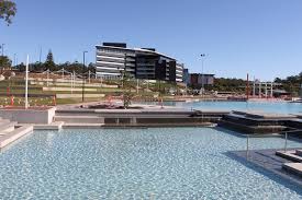
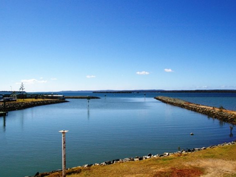
One of the last coastal areas of Redland Shire to undergo development, Redland Bay has become increasing popular over recent years due to its village atmosphere and location right on Moreton Bay. What was once farmland has become new subdivisions featuring well-designed, modern homes, many with views across the bay. Queenslanders, brick and tile as well as older weatherboard homes can also be found in the area. Being located halfway between the Gold Coast and Brisbane ensures Redland Bay can have its pick of which major centre to access. The increasing population in the area, including nearby Victoria Point, has meant investment has been made in education, health and community facilities. There are two shopping centres in nearby Victoria Point, only a five minute drive away from Redland Bay. There are a number of primary and secondary schools with the area’s demographics changing as more young families move into Redland Bay. Source: REIQ

Fast Facts about Redland Bay
  • Population 13,500
  • Median Property Price House: $517,500 Unit: $422,500
  • Median Rent House: $465 PW Unit: $ N/A
  • Number of schools 3
  • Location 35Km southeast of Brisbane
Redland Bay is a township at the southern end of Redland City. Redland Bay is some 35 km (22 miles) south-east of Brisbane, the capital of Queensland, Australia. The township is named for the bay it sits on, which forms part of larger Moreton Bay. The Aboriginal name for the Redland Bay region was Talwalpin after the cottonwood tree which was widespread in the area. Since the first European settlers arrived in the mid-19th century, Redland Bay has remained a farming and fishing-based area until the mid-20th century when some of the farms were subdivided and improved transport infrastructure made it possible for residents to commute the 35 kilometers into Brisbane. The township has long been the port for vessels plying the bay islands. These islands include Russell Island, Macleay Island, Karragarra Island, Lamb Island and North Stradbroke Island, home to several thousand residents enjoying an idyllic, sub-tropical lifestyle. Source: Wikipedia
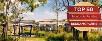
What was once farmland has become new subdivisions featuring well-designed, modern homes, many with views across the bay. Queenslanders, brick and tile as well as older weatherboard homes can also be found in the area. Source: REIQ
There are a number of primary and secondary schools with the area's demographics changing as more young families move into Redland Bay. Source: REIQ
The Redland Bay Flying Boat Base.  Redland Bay also has a number of heritage listed sites including: Redland Bay State School residence on Gordon Road and Serpentine Creek Road Cemetery.
In the 1860s, settlers from England, Germany and Scandinavia began filtering into and along the Logan River and surrounding districts. They found dense forests growing from generally good soil. Particularly rich was the soil of the Redland Bay District which is said to have had lush rainforest complete with prized red cedar. The labour of clearing the forest was long and arduous. One man with an axe might labour for years to clear an area of land that could support a viable farm. The felled timber would then milled to provide building material for the first houses. Locally milled cedar was used for doors, architraves and other feature work on the early houses, such as the original farmhouse on what was to become Mt Carmel Orchard. The character of the red soil was such that over time, it infiltrated itself into and on farm buildings, giving them a characteristic red tinge. One early settler was Arnold Friedrich Muller who took up 50 acres (200,000 m2) of coastal forest north of what is now Point Talburpin. Muller's farmhouse was removed in the 1990s to make way for a stage of the Orchard Beach estate, but its site is still marked by a pair of mature fig trees, planted around 1905, at the top of School of Arts road where it meets Collins Street. While these trees were likely to have been planted for the practical purposes of shading the house from the intense afternoon sun and cold winter westerly winds, they also stand as a symbol of the enduring husband and wife farming partnerships that helped to define the character of Redland Bay. Arnold's eldest son William was born around 1879, the first white man to be born in the district. He died in 1978 at the age of 99. The early farms produced sugar cane, pineapples and citrus. The produce was taken to market by horse-drawn wagon at first, then by the steamboats Pearl, Eucalypta, Louisa and Porpoise, operated by one Captain John Burke. The viability of these crops was reduced as larger farms to the north at Thorneside, Cleveland and Ormiston gained a competitive advantage over Redland Bay, possibly due to access to rail transport. Redland Bay farmers moved towards producing tomatoes, cabbage, cauliflower and passionfruit. These crops continued until farming finally gave way to suburban development around the year 2000. From 2000, Redland Bay has been increasingly populated. Most farms have been replaced by housing, and has its own set of shops. It is relatively close to Victoria Point, and is only a ferry ride away from the bay islands, such as Russell and Macleay. Source: Wikipedia
There are two shopping centres in nearby Victoria Point, only a five minute drive away from Redland Bay. Source: REIQ
Gallery
  • Satelite
  • Transit
  • Bike
  • Comparables

Redland Bay

One of the last coastal areas of Redland Shire to undergo development, Redland Bay has become increasing popular over recent years due to its village atmosphere and location right on Moreton Bay. What was once farmland has become new subdivisions featuring well-designed, modern homes, many with views across the bay. Queenslanders, brick and tile as well as older weatherboard homes can also be found in the area. Being located halfway between the Gold Coast and Brisbane ensures Redland Bay can have its pick of which major centre to access. The increasing population in the area, including nearby Victoria Point, has meant investment has been made in education, health and community facilities. There are two shopping centres in nearby Victoria Point, only a five minute drive away from Redland Bay. There are a number of primary and secondary schools with the area’s demographics changing as more young families move into Redland Bay. Source: REIQ

Fast Facts about Redland Bay
  • Population 13,500
  • Median Property Price House: $517,500 Unit: $422,500
  • Median Rent House: $465 PW Unit: $ N/A
  • Number of schools 3
  • Location 35Km southeast of Brisbane
Redland Bay is a township at the southern end of Redland City. Redland Bay is some 35 km (22 miles) south-east of Brisbane, the capital of Queensland, Australia. The township is named for the bay it sits on, which forms part of larger Moreton Bay. The Aboriginal name for the Redland Bay region was Talwalpin after the cottonwood tree which was widespread in the area. Since the first European settlers arrived in the mid-19th century, Redland Bay has remained a farming and fishing-based area until the mid-20th century when some of the farms were subdivided and improved transport infrastructure made it possible for residents to commute the 35 kilometers into Brisbane. The township has long been the port for vessels plying the bay islands. These islands include Russell Island, Macleay Island, Karragarra Island, Lamb Island and North Stradbroke Island, home to several thousand residents enjoying an idyllic, sub-tropical lifestyle. Source: Wikipedia
What was once farmland has become new subdivisions featuring well-designed, modern homes, many with views across the bay. Queenslanders, brick and tile as well as older weatherboard homes can also be found in the area. Source: REIQ
There are a number of primary and secondary schools with the area's demographics changing as more young families move into Redland Bay. Source: REIQ
The Redland Bay Flying Boat Base.  Redland Bay also has a number of heritage listed sites including: Redland Bay State School residence on Gordon Road and Serpentine Creek Road Cemetery.
In the 1860s, settlers from England, Germany and Scandinavia began filtering into and along the Logan River and surrounding districts. They found dense forests growing from generally good soil. Particularly rich was the soil of the Redland Bay District which is said to have had lush rainforest complete with prized red cedar. The labour of clearing the forest was long and arduous. One man with an axe might labour for years to clear an area of land that could support a viable farm. The felled timber would then milled to provide building material for the first houses. Locally milled cedar was used for doors, architraves and other feature work on the early houses, such as the original farmhouse on what was to become Mt Carmel Orchard. The character of the red soil was such that over time, it infiltrated itself into and on farm buildings, giving them a characteristic red tinge. One early settler was Arnold Friedrich Muller who took up 50 acres (200,000 m2) of coastal forest north of what is now Point Talburpin. Muller's farmhouse was removed in the 1990s to make way for a stage of the Orchard Beach estate, but its site is still marked by a pair of mature fig trees, planted around 1905, at the top of School of Arts road where it meets Collins Street. While these trees were likely to have been planted for the practical purposes of shading the house from the intense afternoon sun and cold winter westerly winds, they also stand as a symbol of the enduring husband and wife farming partnerships that helped to define the character of Redland Bay. Arnold's eldest son William was born around 1879, the first white man to be born in the district. He died in 1978 at the age of 99. The early farms produced sugar cane, pineapples and citrus. The produce was taken to market by horse-drawn wagon at first, then by the steamboats Pearl, Eucalypta, Louisa and Porpoise, operated by one Captain John Burke. The viability of these crops was reduced as larger farms to the north at Thorneside, Cleveland and Ormiston gained a competitive advantage over Redland Bay, possibly due to access to rail transport. Redland Bay farmers moved towards producing tomatoes, cabbage, cauliflower and passionfruit. These crops continued until farming finally gave way to suburban development around the year 2000. From 2000, Redland Bay has been increasingly populated. Most farms have been replaced by housing, and has its own set of shops. It is relatively close to Victoria Point, and is only a ferry ride away from the bay islands, such as Russell and Macleay. Source: Wikipedia
There are two shopping centres in nearby Victoria Point, only a five minute drive away from Redland Bay. Source: REIQ
Gallery
  • Satelite
  • Transit
  • Bike
  • Comparables

Redland Bay